
 Complaint
Regional workshop on modeling tsunami wave inundation and preparing evacuation plans
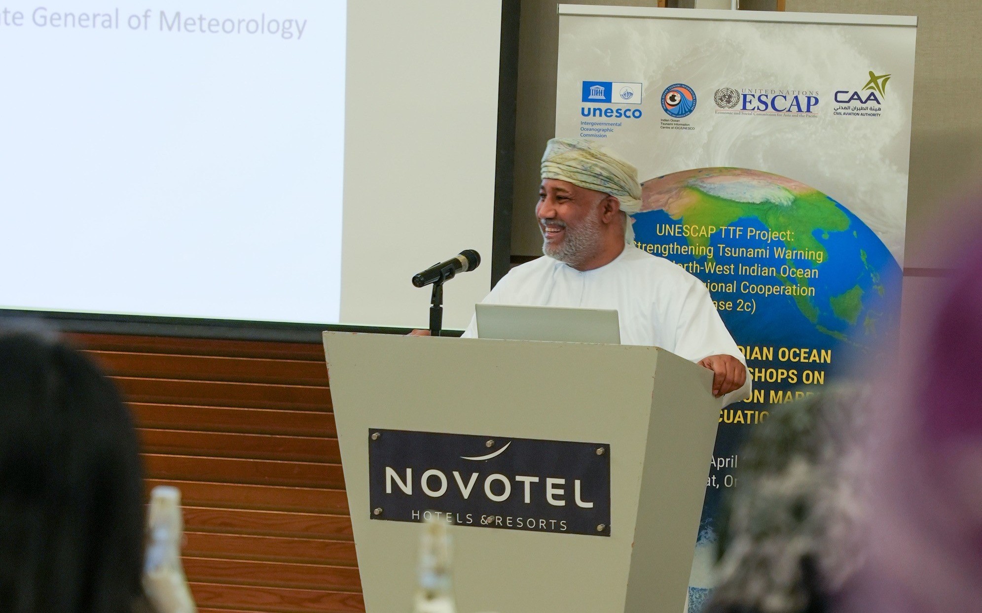
The regional workshop focusing on modeling tsunami wave inundation and formulating evacuation plans for the northwest Indian Ocean has commenced. Hosted by Oman and represented by the National Center for Early Warning of Multiple Risks at the Civil Aviation Authority, this workshop will be held from April 21st to April 25th, 2024. It brings together seventy (70) participants and experts from various national and regional centers in countries surrounding the northwest Indian Ocean, including the United Arab Emirates, India, Pakistan, the Islamic Republic of Iran, Indonesia, and Australia. Additionally, representatives from the National Emergency Management Committee, the Civil Defense and Ambulance Authority, and academics from Sultan Qaboos University are actively engaged in this event.
The workshop is divided into two sub-workshops. The first focuses on topics related to tsunami inundation map models, while the second deals with preparing evacuation plan models for tsunami wave risks. Specific coastal areas in Oman and neighboring countries in the northwest Indian Ocean will serve as reference models. This includes the preparation of inundation and evacuation maps tailored to these communities. As part of the workshop, participants will visit one of the selected areas in Oman for a field visit.
The workshop's objectives are geared towards ensuring communities can effectively respond to tsunami risks, aligning with UNESCO's Intergovernmental Oceanographic Commission's Tsunami Programme. This initiative aims to achieve full preparedness, reaching 100% readiness for at-risk communities by 2030.
Furthermore, the workshop aims to achieve several key outcomes. These include conducting a comprehensive review of previous workshop materials and providing an overview of completed initiatives. It also seeks to improve communication channels between regional and national centers, foster discussions, and exchange ideas and practices related to inundation map preparation. Additionally, the workshop will involve evaluating current inundation maps resulting from tsunami waves, organizing field trips for comparative analysis of workshop-prepared maps, training participants in standard map preparation techniques, and engaging in discussions about future plans and activities within project scopes and associated agreements.
The workshop is an extension of previous sessions focusing on tsunami waves, warnings, and awareness. These sessions are part of a larger project aimed at improving tsunami warnings in the northwest Indian Ocean region, supported by the United Nations Economic and Social Commission for Asia and the Pacific (UNESCAP) and the Intergovernmental Oceanographic Commission of UNESCO (IOC-UNESCO).